By Saeed Mirshekari
August 17, 2024


Access O'Mentors
Top Data Scientist Mentors from Fortune 500 Companies excited to help you out 1-on-1!
1️⃣ Explore freely
→
2️⃣ Apply confidently
→
3️⃣ Pay securely
→
4️⃣ Book instantly
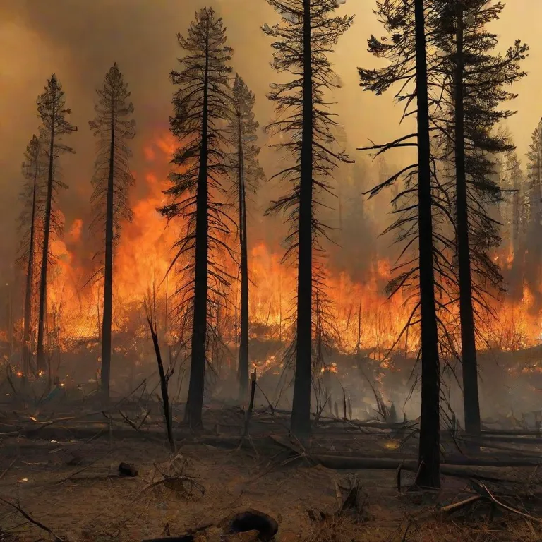
Understanding Wildfires: The Power of Data Analysis in Prediction and Mitigation
Wildfires have been a devastating force of nature throughout history, impacting landscapes, wildlife, and communities. With climate change exacerbating their frequency and intensity, understanding the statistics behind wildfires and employing advanced data analysis techniques have become crucial in predicting and minimizing their destructive effects. In this article, we delve into the statistics of wildfires, explore the role of data analysis in prediction, discuss strategies for minimizing loss, and examine notable historical wildfires in the US.
The Statistical Landscape of Wildfires
Frequency and Severity
According to recent studies, the frequency and severity of wildfires have been on the rise globally. Factors such as prolonged droughts, higher temperatures, and human activity have contributed to this increase. In the United States alone, wildfires have become more frequent, burning larger areas of land and causing significant economic and environmental damage.
Geographic Distribution
Wildfires are not evenly distributed geographically. Certain regions are more prone to wildfires due to factors such as climate, vegetation, and topography. For example, the western United States experiences a high frequency of wildfires, particularly in states like California, Oregon, and Washington, where dry conditions and dense forests create ideal conditions for fire ignition and spread.
Economic and Environmental Impact
The economic and environmental impact of wildfires is substantial. Direct costs include property damage, firefighting efforts, and loss of livelihoods. Indirect costs encompass health issues from smoke inhalation, loss of biodiversity, and long-term environmental degradation. The cumulative effect of wildfires on ecosystems and communities can be profound and long-lasting.
The Role of Data Analysis in Prediction
Historical Data
One of the primary tools for predicting wildfires is historical data analysis. By studying past wildfire events, researchers can identify patterns, trends, and risk factors. Factors such as weather conditions, vegetation types, and human activities play significant roles in determining wildfire behavior. Analyzing historical data allows scientists to develop models and algorithms to forecast future wildfire occurrences.
Remote Sensing and Satellite Imagery
Remote sensing technologies, including satellite imagery and aerial surveys, provide valuable data for wildfire prediction and monitoring. These tools can detect changes in vegetation, land surface temperatures, and smoke plumes, enabling early detection of wildfire outbreaks. Data collected from remote sensing platforms are integrated into predictive models, enhancing their accuracy and effectiveness.
Machine Learning and Predictive Modeling
Advancements in machine learning and predictive modeling have revolutionized wildfire prediction efforts. By leveraging algorithms trained on vast amounts of data, researchers can forecast wildfire likelihood, spread patterns, and potential impacts with greater precision. Machine learning techniques such as neural networks, random forests, and support vector machines enable the analysis of complex datasets and the identification of subtle relationships between variables.
Real-time Monitoring and Alert Systems
Real-time monitoring and alert systems play a critical role in wildfire prevention and response. These systems integrate data from various sources, including weather stations, remote sensors, and satellite networks, to provide early warnings and situational awareness. By continuously analyzing incoming data and updating risk assessments, these systems help emergency responders allocate resources effectively and implement timely evacuation measures.
Strategies for Minimizing Loss
Prescribed Burns
Prescribed burns, also known as controlled burns, are proactive wildfire mitigation strategies used to reduce fuel loads and minimize wildfire risk. By intentionally burning vegetation under controlled conditions, land managers can prevent the buildup of combustible materials and create firebreaks to impede wildfire spread. Prescribed burns also promote ecosystem health, stimulate plant regeneration, and reduce the intensity of future wildfires.
Community Preparedness and Education
Community preparedness and education are crucial components of wildfire mitigation efforts. Public awareness campaigns, evacuation drills, and community meetings help residents understand wildfire risks and take proactive measures to protect their homes and properties. Collaboration between government agencies, fire departments, and community organizations is essential for developing comprehensive wildfire response plans and implementing effective mitigation strategies.
Land Use Planning and Zoning Regulations
Land use planning and zoning regulations play a significant role in minimizing wildfire risk in vulnerable areas. By incorporating wildfire hazard mapping, building codes, and land management policies into urban and rural planning processes, communities can reduce exposure to wildfire threats and safeguard critical infrastructure. Zoning regulations can limit development in high-risk areas, establish buffer zones between wildlands and urban areas, and promote sustainable land management practices.
Early Warning Systems and Rapid Response
Early warning systems and rapid response capabilities are essential for minimizing loss during wildfire events. By leveraging advanced technologies such as automated sensors, drones, and predictive analytics, emergency responders can detect wildfires in their early stages and deploy resources swiftly to contain and extinguish them. Timely evacuation orders, communication systems, and emergency shelters are critical components of effective wildfire response strategies.
Historical Big Wildfires in the US
1. Great Fire of 1910 (The Big Blowup)
The Great Fire of 1910, also known as The Big Blowup, was one of the most significant wildfires in US history. It occurred in the Northern Rockies, primarily in Idaho and Montana, during the summer of 1910. Fueled by drought conditions, high winds, and abundant fuel sources, the firestorm consumed approximately 3 million acres of land and destroyed numerous towns and settlements. The Great Fire of 1910 led to significant changes in wildfire management policies and the establishment of the US Forest Service's firefighting efforts.
2. Yellowstone Fires of 1988
The Yellowstone Fires of 1988 were a series of wildfires that ravaged Yellowstone National Park and its surrounding areas in Wyoming, Montana, and Idaho. Sparked by lightning strikes and fueled by dry conditions and strong winds, the fires burned for several months, scorching over 793,000 acres of land within the park. The Yellowstone Fires of 1988 drew international attention and sparked debates about wildfire management practices, ecosystem resilience, and the role of natural processes in fire-adapted landscapes.
3. Cedar Fire (2003)
The Cedar Fire of 2003 was one of the largest and most destructive wildfires in California's history. Ignited by a lost hunter's signal fire in the Cleveland National Forest, the Cedar Fire quickly spread due to Santa Ana wind conditions and dry vegetation. The fire burned for over a week, consuming approximately 280,000 acres of land and destroying over 2,800 structures, including homes and businesses. The Cedar Fire highlighted the challenges of wildfire suppression in rugged terrain and the importance of community preparedness and evacuation planning.
4. Camp Fire (2018)
The Camp Fire of 2018, named after its place of origin near Camp Creek Road in Butte County, California, was the deadliest and most destructive wildfire in the state's history. Sparked by electrical transmission lines owned by Pacific Gas and Electric Company (PG&E), the fire spread rapidly due to dry conditions and strong winds. The Camp Fire burned for over two weeks, consuming approximately 153,000 acres of land and destroying more than 18,000 structures, including the majority of the town of Paradise. The Camp Fire underscored the need for utility companies to prioritize wildfire prevention measures and for communities to implement robust evacuation plans and building codes to mitigate wildfire risk.
Conclusion
The statistics of wildfires paint a sobering picture of their frequency, severity, and impact on ecosystems and communities. However, through the power of data analysis, predictive modeling, and proactive mitigation strategies, we can enhance our ability to predict and minimize the loss caused by wildfires. By leveraging historical data, remote sensing technologies, and machine learning algorithms, we can develop more accurate wildfire prediction models